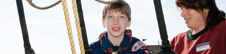
Navigation Map & Compass Overnight for Cub Scouts
Scouts and caretakers explore the world of maps and compasses together! You will get to see and handle many different types of maps and learn how the different parts of the map provide information. We will go over compass parts and show how to use the map and compass together to orientate a map to magnetic north and true north. Later in the evening you and your child get to test your knowledge by naming states on a blank US map and to test you memory by drawing a map of your neighborhood and plotting your way from home to a place you go often. We will also take a walk over to the Mystic River Scale Model to see a 3d map (diorama) first hand. Spend the night aboard historic square rigged ship Joseph Conrad. Dine at the Galley Restaurant and participate in the sailor's activity or craft in the morning. After your time with us concludes, enjoy self touring the museum for the rest of the day.
-
Day 1
-
6:50 - 7 pm. Meet the Seaport Staff in the Main/South Parking lot.
-
7 pm. Program begins with an orientation to the program, Mystic Seaport and the Joseph Conrad.
-
7:30 p.m. Move On Board and Practice a Fire Drill
-
8 pm. Activity Period #1 - Instructor lead, parent/child classroom exploration of maps, map parts, the compass and compass parts.
-
8:30ish pm. Pizza snack!
-
9 pm. Activity Period #2 - Visit Scale Model, Scout Badge Activities Belt Loop #3 and Pin #'s 6 &7
-
10 pm. Lights Out - Sleep aboard the historic square rigged ship Joseph Conrad.
-
Day 2
-
7 a.m. Reveille, clean ship, stow gear in cars.
-
8:15 a.m. Breakfast in our Galley Restaurant.
-
9 a.m. Activity Period #3 - Rigging Climb (weather permitting) or a sailors craft or a full ship or building tour.
-
9:45a.m. - on... Enjoy a day on your own exploring the museum.
Activity Period # 1 covers: Belt Loop: #1 -Show how to orient a map. Find three landmarks on the map. #2 - Explain how a compass works. Pin: #1 - Define cartography. #5 - Explain the difference between latitude and longitude and show them on a map or globe. #9 - Show how to measure distances, using a scale on a map legend. #12 Explain what the different map colors can mean on a map.
Activity Period #2 covers: Belt Loop: #3 - Draw a map of your neighborhood. Label the streets and plot the route you take to get to a place that you often visit. Pin: #6 - Draw a compass rose for a map. Label north, south, east, and west. #7 - Study a blank map of the United States of America. Label your state, and the states that share its boundary lines.
You receive a Mystic Seaport Anchor Watch patch for participating in the program.
Mystic Seaport does not provide the belt loop and pin earned.
Click here for the Health Form
 Login
Login Contact Us
 Join Now
.png)
 Calendar
.jpg)